
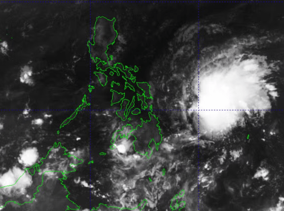
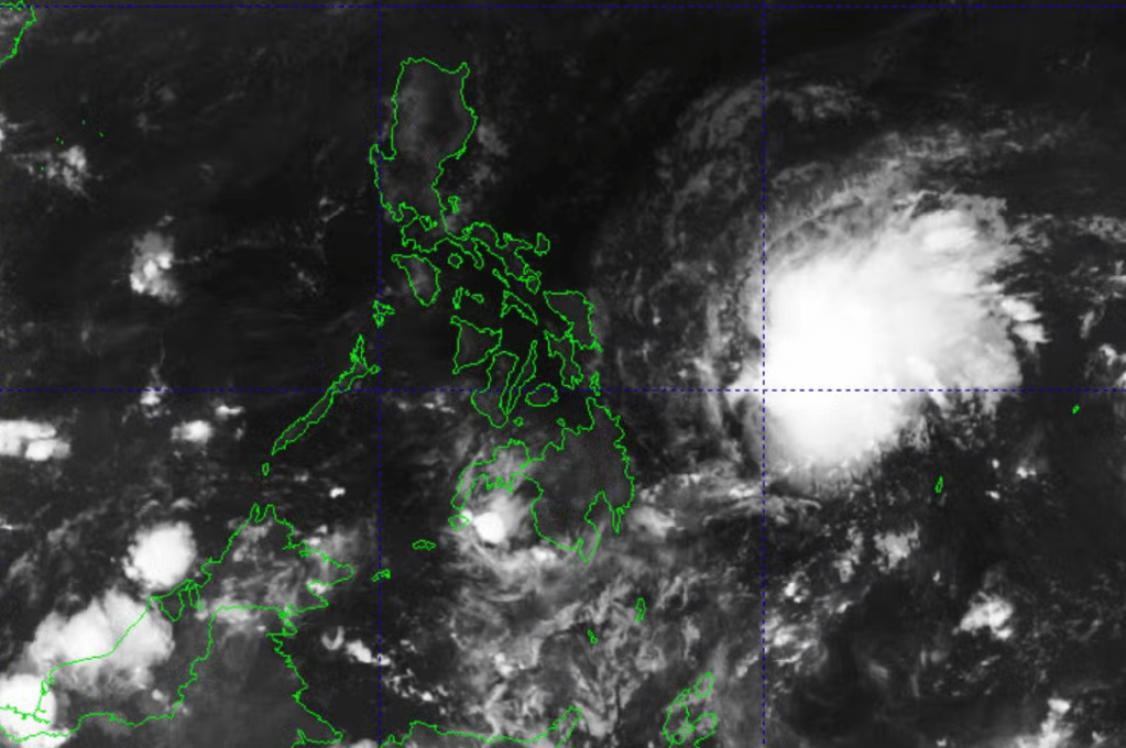
MANILA, Philippines — The state weather bureau PAGASA reported on Monday morning, May 11, 2026, that Tropical Depression Caloy is expected to further lose strength and weaken into a Low Pressure Area (LPA) within the day. As of the 5:00 AM bulletin, Caloy was last spotted approximately 530 kilometers east of Guiuan, Eastern Samar.
The weather disturbance, which reached tropical storm intensity over the weekend, has been gradually weakening due to unfavorable environmental conditions in the Philippine Sea.
| Metric | Detail (as of 4:00 AM, May 11) |
| Location | 530 km East of Guiuan, Eastern Samar |
| Maximum Sustained Winds | 45 km/h |
| Gustiness | Up to 55 km/h |
| Movement | West-northwestward at 15 km/h |
| Direct Landfall Risk | None; expected to remain far from land. |
Despite its weakening status and distance from the Philippine landmass, Caloy’s presence is still influencing local weather patterns:
- Trough Effects: The “trough” or extension of Caloy is expected to bring cloudy skies with scattered rain showers and thunderstorms over Eastern Samar and the Dinagat Islands on Monday.
- Easterlies: In Metro Manila and the rest of the country, the easterlies (warm winds from the Pacific) will continue to bring hot and humid weather, with isolated thunderstorms possible in the afternoon or evening.
- Marine Conditions: While no gale warnings have been raised, moderate seas are expected over the eastern seaboards of Luzon, Visayas, and Mindanao. Small seacraft are advised to take precautions.
While monitoring the cyclone, PAGASA also issued a “danger” level heat index warning for 28 areas across the country today. Indices are expected to range between 42°C and 47°C, particularly in the following regions:
- Cagayan Valley (Aparri and Tuguegarao)
- Central Luzon (Cabanatuan and Dagupan)
- Bicol Region (Legazpi and Virac)
- Western Visayas (Iloilo and Roxas City)
Another Low Pressure Area is currently being monitored approximately 2,100 km east of Mindanao, outside the Philippine Area of Responsibility (PAR). PAGASA weather specialists noted that this second disturbance currently has a low risk of developing into a tropical cyclone.
Residents in rain-affected areas are advised to monitor for potential flash floods or landslides during heavy thunderstorms, while the general public is urged to stay hydrated to combat the high heat index.