
MADRID – Spanish tech company GMV has launched a groundbreaking lunar navigation system designed to function like GPS for the Moon, enabling rovers and astronauts to navigate the lunar surface in real time, similar to using Google Maps on Earth.
Dubbed LUPIN, the system is part of a European Space Agency initiative to test advanced navigation, positioning, and timing technologies as interest in lunar exploration surges. LUPIN aims to support upcoming scientific missions, mining exploration, and even potential lunar tourism.
“This project brings Europe a step closer to human settlement on the Moon and could pave the way for Mars missions,” said Steven Kay, LUPIN’s project director.
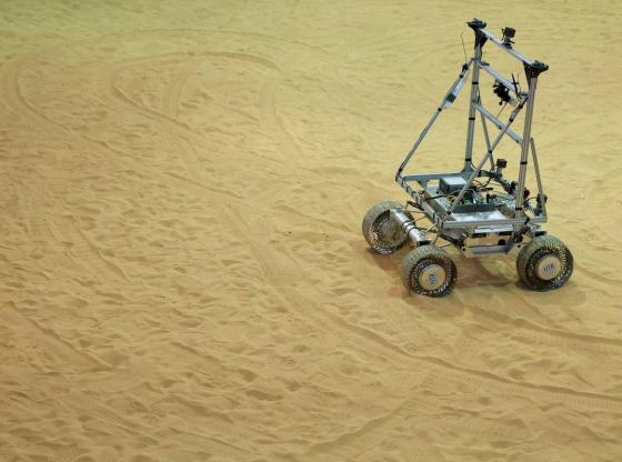
GMV tested the technology in the rugged terrain of Fuerteventura in Spain’s Canary Islands, chosen for its resemblance to the Moon’s surface. Using signals from lunar orbiters, LUPIN enables precise, real-time location tracking—something traditional Earth-based systems can’t offer due to delays and coverage gaps.
Currently, lunar missions rely on complex Earth-based data relays that lack immediacy and struggle in areas without a clear line of sight to Earth. These limitations, along with lunar dust and uncharted terrain changes, make real-time navigation challenging.
LUPIN addresses these gaps by combining high-resolution lunar maps with satellite data focused on hard-to-reach areas like the Moon’s south pole and far side. The system aims to help rovers safely map the surface, supporting long-term astronaut missions and the setup of permanent lunar bases.
“We want to enable faster, safer exploration so humans can work and live on the Moon,” said GMV strategy chief Mariella Graziano.