
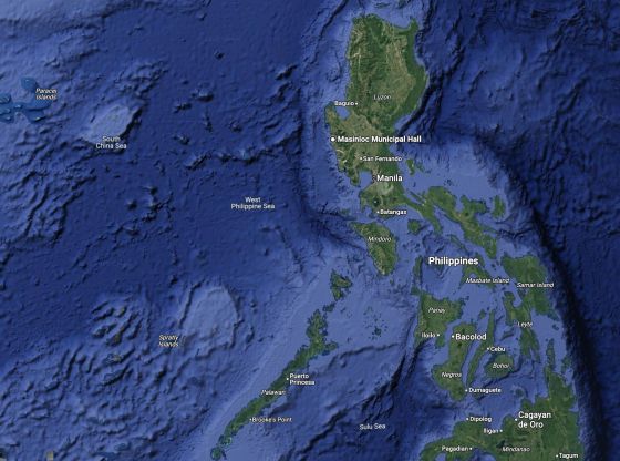
Google has clarified that the “West Philippine Sea” label has always been present on its Maps platform, but was recently made more visible to users.
The statement follows public attention after users noticed the label appearing more prominently when searching for areas like Scarborough Shoal, which lies within the Philippines’ exclusive economic zone (EEZ).
“We’ve always had the West Philippine Sea labeled on Google Maps. We’ve just made it more noticeable at certain zoom levels,” the tech giant explained.
This update brings renewed focus on the West Philippine Sea — a term officially adopted in 2012 under then-President Benigno Aquino III. Through Administrative Order No. 29, the Philippines named the maritime areas west of the archipelago, including the Luzon Sea, Kalayaan Island Group, and Bajo de Masinloc (Scarborough Shoal), as the West Philippine Sea.
In 2016, the Permanent Court of Arbitration ruled in favor of the Philippines against China’s expansive claims in the South China Sea. The decision affirmed that Scarborough Shoal, Ayungin Shoal, Mischief Reef, and Recto Bank fall within the Philippines’ EEZ and designated Scarborough Shoal as a shared fishing area.
Despite the international ruling, China continues to reject the verdict and has remained aggressive in the disputed waters, including recent incidents of water cannon use and ramming of Philippine vessels.